Nambiar Beverly Green Location
Bilwaradahalli, on Bannerghatta Road, south Bangalore, Karnataka 560083, 3 km from the Bannerghatta Nature Camp. Exact address, coordinates and corridor connectivity below.
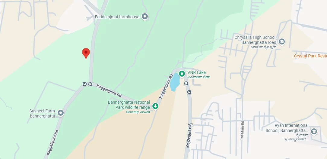
Location
Nambiar Beverly Green location is at Bilwaradahalli, on Bannerghatta Road in south Bangalore, Karnataka 560083. The site is geo-tagged at 12.823744° N, 77.571837° E and is approximately 3 km from the Bannerghatta Nature Camp operated by Jungle Lodges and Resorts. This is the stretch of Bannerghatta Road where the dense urban development begins to thin and the wooded surroundings of Bannerghatta National Park come closer. Bannerghatta Road is State Highway 87, beginning at Hosur Road at Adugodi and continuing south through Arekere, Hulimavu and Gottigere before reaching the national park. The postal head office for this location is Gottigere, and the site comes under the Bangalore South constituency.
Nambiar Beverly Green Address
- Locality: Bilwaradahalli, Bannerghatta Road; postal head office Gottigere.
- Road: Bannerghatta Road (State Highway 87), south Bangalore.
- Pincode: Bangalore, Karnataka – 560083.
- Latitude: 12.823744
- Longitude: 77.571837
Nambiar Beverly Green Connectivity
Nambiar Beverly Green connectivity is built around a single primary corridor: Bannerghatta Road passes the site and connects north towards Bangalore and south towards the national park. The Outer Ring Road, the NICE Road peripheral, metro network and airport are all accessed through this road. The key distances are 3 km to the Bannerghatta Nature Camp, 15 km to Electronic City (about 30 minutes), 12.5 km to the nearest operational metro stations at Yelachenahalli and Silk Institute on the Green Line, while Kalena Agrahara on the Pink Line is closer at 6.3 km but is not yet open, and 68 km to Kempegowda International Airport, roughly 2 hours.
The complete school, hospital, mall, technology-park and bus-stop distances are covered in the sections below. Every landmark mentioned on this page has a measured distance rather than an estimate; where no measured figure is available, that is stated clearly and the relationship is described instead, with the coordinates above available for independent measurement. Travel times are typical and can change with traffic.
Kempegowda International Airport is located on the far northern side of the metropolitan area, effectively the opposite end of the city from this address, making it the longest regular journey for residents here. It is 68 km away: 2 h by car, 1 h 58 min by bike. That is a substantial distance, and it is better to state it directly than hide it: this is a south Bangalore location while the airport is north of the city, so the journey should be factored into any travel planning. There are two common routes: north along Bannerghatta Road and through the city towards the Outer Ring Road at Hebbal, or west via the NICE Road from the Gottigere junction and onward towards Tumkur Road. Neither route is short, and both are highly dependent on traffic conditions, so treat two hours as a typical travel time rather than a guaranteed minimum and allow additional time for an early flight.
The nearest metro station in service today is 12.5 km away. Yelachenahalli and Silk Institute, located at the southern end of the operational Green Line of Namma Metro, are each 12.5 km from the site. Kalena Agrahara is closer at 6.3 km north of the property along Bannerghatta Road, but it is not open. It is the southern terminus of the Pink Line, and no portion of that line is currently carrying passengers.
| Station | Line | Distance from the site | Status |
|---|---|---|---|
| Yelachenahalli | Green Line | 12.5 km | Operational today |
| Silk Institute | Green Line | 12.5 km | Operational today |
| Kalena Agrahara | Pink Line | 6.3 km | Not open, expected September 2026 |
Bannerghatta Road forms the alignment of the Pink Line , which is planned from Kalena Agrahara, formerly known as Gottigere station, northwards to Nagawara. The six southernmost stations are elevated and located along Bannerghatta Road itself: Kalena Agrahara, Hulimavu, IIMB, Jayaprakash Nagar 4th Phase, Jayadeva Hospital and Tavarekere. The remaining twelve stations are underground through central Bangalore. The 7.5 km elevated stretch from Kalena Agrahara to Tavarekere was scheduled to open on 15 August 2026; Deccan Herald reported in July 2026 that this deadline would be missed and that opening was then expected in late August or early September, with signalling validation still pending before the statutory safety inspection. The 13.76 km underground section extends from Tavarekere to Nagawara, while the minister's stated deadline for the complete corridor is March 2027, as reported in June 2026 by The Hindu and The New Indian Express. Both dates should be viewed as expectations rather than firm commitments, as the corridor has already faced delays. Verify the latest position with BMRCL before treating future metro access as a deciding factor. The expected journey to the city centre is around 25 minutes once the line becomes operational; this is a projection for a service that has not yet commenced, not a measured journey time.
Road and Highway Network
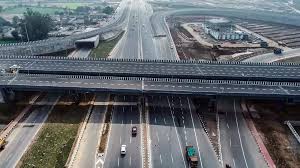
State Highway 87 is the principal road serving this site. It covers 45 km overall, branching from Hosur Road at Adugodi and taking the Bannerghatta Road name through Arekere, Hulimavu and Gottigere before passing Bannerghatta National Park. Beyond that, it continues as the Jigani–Anekal and Anekal–Hosur roads before ending at Samanduru near the Tamil Nadu border. Two junctions are particularly relevant here. The Outer Ring Road intersects at Jayadeva Hospital, providing access to the city's southern and eastern sections. The NICE Road peripheral intersects near Gottigere, making it the more practical connection for this end of the corridor: it provides an eastward route towards Hosur Road, Electronic City and Bommasandra without requiring travel through central Bangalore, and also connects west and north towards Mysore Road and Tumkur Road. Jigani's industrial belt is also located along the same highway, east of Bannerghatta.
Rail Connectivity

Rail connectivity is the weaker link here, and it is more useful to state that plainly than to overstate it. There is no railway station on the Bannerghatta Road corridor, and none of the four Bengaluru Suburban Railway corridors runs along this road. Those corridors instead serve the Devanahalli, Chikkabanavara, Whitefield and Hosur-side directions. Mainline train departures are available from KSR Bengaluru City and Bengaluru Cantonment in central Bangalore; the nearest suburban halts are off the corridor towards the east on the Bengaluru–Hosur line and can be reached through the NICE Road. For this location, plan on road travel or, once operational, metro access from the northern Bannerghatta Road stretch.
BMTC operates services along Bannerghatta Road from central Bangalore towards Bannerghatta. Since the road is the primary spine through this area, it also serves settlements including Hulimavu, Gottigere, Kalena Agrahara, Bilwaradahalli and Bannerghatta. Three BMTC stops serve this address, each with a measured distance. The distance itself is less important than the frequency and usefulness of the service available at each stop.
The Nearest Stop Is Close, but Thinly Served
Bilavaradahalli Cross is 190 m from the main gate, approximately a two-minute walk, but it has about fourteen departures a day. Both figures matter together: although the stop is extremely close, fourteen departures means a daily commuter needs to plan around specific bus timings. Anyone relying on a bus daily should plan around Bilavaradahalli at 1.5 km or Bannerughatta Circle at 2.3 km, where the frequent Majestic services operate. Routes 365-D, 365-DB and 365-E connect from the first towards Kempegowda Bus Station, while Bannerughatta Circle carries the busiest group of services. Both locations require a drive, auto ride or a ride on the 211-NB from the stop near the gate rather than being practical walking destinations. From Majestic, the journey is about 1 h 13 min to Bannerughatta Circle and about 1 h 7 min to Bilavaradahalli.
The first bus is 5:51 AM and the last is 7:04 PM, meaning there is no evening or night service from the stop at the gate. There is also a gap of more than two hours between the 9:59 AM and 12:14 PM services. The complete fourteen-departure timetable is available on the connectivity page. Timings as shown on Google Maps in July 2026. BMTC schedules change, check the live departure board at mybmtc.karnataka.gov.in before you travel.
A Direct Bus to the Airport
KIA-14A runs from Bannerughatta Circle direct to Kempegowda International Airport. With the airport located 68 km away and around two hours by car, a direct airport service from a stop 2.3 km from the main gate is genuinely useful and can easily be overlooked when reviewing the route list.
Routes, Not Timetables, and the Spelling
The complete day's service is listed for Bilavaradahalli Cross because all fourteen departures for that stop are available from the first service to the last. No timings are published for Bilavaradahalli or Bannerughatta Circle: the information available for those two stops covers only partial time windows rather than a full day's schedule, and presenting those as complete timetables would understate the service available at the two stops that actually have frequent connectivity. Regarding spelling, BMTC uses Bilavaradahalli and Bannerughatta for the stops, while this site uses Bilwaradahalli for the locality and Bannerghatta Road for the corridor based on the project's postal address. These are different spellings for the same village and road. Within the community, the master plan also provides a dedicated bus bay at the entrance plaza.
Nambiar Beverly Green, What Is Where on the Corridor
This table focuses on direction and route rather than introducing unsupported kilometres. A distance is shown only where a sourced figure is available, specifically for the Nature Camp and metro stations. The measured school, hospital, mall and technology-park distances are provided in their respective sections below.
Places to Visit Near Nambiar Beverly Green
Bannerghatta Road is among the few Bangalore arterial roads that finishes towards forest rather than continuing into another suburban belt, and that character defines the southern section where the site is located.
Bannerghatta Nature Camp, 3 km
The Jungle Lodges and Resorts camp is located on the Bannerghatta Biological Park campus, near the Hakki-Pikki colony. Its proximity best illustrates the character of this location: the site is three kilometres from a forest camp while still being connected to a road served by city buses.
Bannerghatta Biological Park and National Park
The zoo, safari and butterfly park occupy part of the larger national park at the southern end of Bannerghatta Road. The Nature Camp is situated on the same campus, so the route to all of them is essentially the same. For residents living at this end of the corridor, it can function as a regular family outing rather than an occasional once-a-year destination.
Anekal Town
Anekal is a market town with old temples and local eateries, located farther along the same State Highway 87 beyond Bannerghatta and Jigani. It is useful as a weekend destination rather than something typically treated as a nearby neighbourhood errand.
Muthyala Maduvu (Pearl Valley), near Anekal
Muthyala Maduvu, also known as Pearl Valley, is a small waterfall and green valley beyond Anekal, again on the SH-87 side of the map. It works as an easy half-day picnic destination and can be reached along the same general route as Anekal.
Bilwaradahalli and the Southern Reach of Bannerghatta Road
Bilwaradahalli is one of the villages located along Bannerghatta Road between Gottigere and Bannerghatta, sharing the 560083 pincode with Bannerghatta, Kalkere, Ragihalli and Sakalavara. It is not a fully built-up suburb and does not have that character: the area remains a mix of granite and farmland that has gradually been transitioning towards residential development from the Gottigere side, with one gated community at a time as Bangalore's expansion moved beyond the NICE Road. What makes this southern edge different is the natural limit to that expansion. Since the road ultimately reaches the national park instead of continuing into another suburban area, this end of the corridor has retained a greener character compared with many other Bangalore arterial roads.
Why the Location of Nambiar Beverly Green Matters
Three factors define this address. First, it sits on a major arterial with a metro corridor being developed along its northern half, which is unusual for a location that is only three kilometres from forest. Second, the NICE Road crossing at Gottigere acts as an important alternative connection, bringing Electronic City, Bommasandra and Hosur Road within reach without requiring a journey through central Bangalore. That makes a south-Bangalore location more practical for households commuting east. Third, the green edge is deliberately reflected in the project itself: the master plan includes six landscaped parks along the southern boundary, supported by 12 m internal roads, an entrance plaza and a small retail block at the gate.
What a Buyer Is Actually Getting Here
This is a villa community rather than a land-banking proposition. The purchase is a built G+2 villa on either a 1,925 sq.ft. or 2,520 sq.ft. plot, with four bedrooms, a private lift serving all three levels and a second floor designed around terrace space. Villas are offered at an indicative ₹13,499 per sq.ft. of saleable area, starting at approximately ₹5.48 Cr for a 35 × 55 villa and ₹6.82 Cr for a 40 × 63 villa, inclusive of 5% GST and excluding registration and stamp duty. These are indicative pre-launch figures and can change. No appreciation forecast is provided for this corridor because there is no sourced figure for one.
Schools & Colleges
Ten schools have measured distances and typical travel times from the site, by car and bike, ranging from Ryan International School at 3 km and 8 minutes to Delhi Public School Bengaluru South at 13 km, 34 minutes by car and 33 by bike. They are presented below in order of proximity. Travel times are typical and vary with traffic and time of day. The complete page, including the corridor schools and colleges listed by street address only, is the schools near Nambiar Beverly Green page.